What is a lease plan?
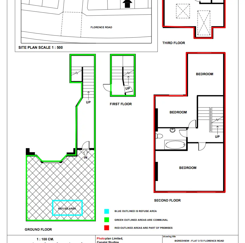
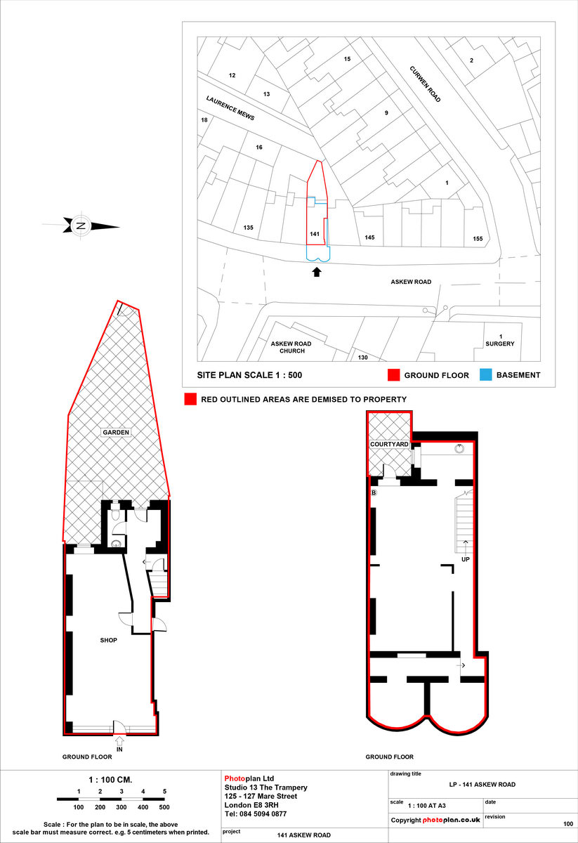
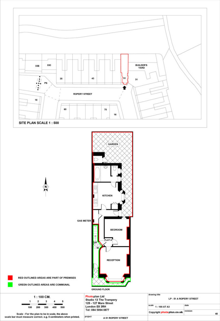
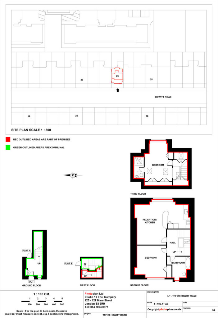
A lease plan is a scaled drawing used to identify property ownership boundaries for leasehold registration with HM Land Registry.. It defines the demised area being leased, edged in red, and shows the property’s position on an Ordnance Survey location plan. A compliant lease plan is required when registering a lease of more than seven years, extending a lease, or transferring part of a registered title.
- Scaled floor plan with a metric scale and scale bar
- Demised area edged in red
- Shared and communal areas shown in green where relevant
- North point and floor levels labelled
- Ordnance Survey location plan