
Transfer of part plans
Required when part of a registered title is sold, transferred or leased. The plan must clearly identify the land being transferred and align with the current approved title plan.
Get a fixed quoteScaled, Ordnance Survey aligned plans for transfers of part, first registrations, plot sales and splitting titles — prepared to HM Land Registry Practice Guide 40, across England and Wales.

Commission a new application plan, or retrieve an existing document already held by HM Land Registry.
For a transfer of part, first registration, plot sale, title split, amalgamation or boundary application.
If you only need the Title Plan or Title Register already held by HM Land Registry, use our separate document retrieval service.
HM Land Registry currently charges £7 for a standard online copy. Our assisted retrieval service includes human address checking, support, secure delivery and document storage.
HM Land Registry holds an existing title plan showing the general extent of a registered title. When you make an application — a transfer of part, first registration, plot sale or title split — you must supply your own scaled application plan. We prepare these plans in AutoCAD, aligned with Ordnance Survey mapping and current Practice Guide 40 guidance.
Read our complete guide to title plans, title registers and property boundaries
These applications need a newly prepared, scaled plan — not a copy of the title plan already held by HM Land Registry.
| Your situation | Application plan required |
|---|---|
| Selling or transferring part of a registered title | Transfer of part plan |
| First registration of unregistered land | First registration plan |
| New-build plot sales within a development | Plot or estate plan |
| Splitting one registered title into two or more | Title split plan |
| Combining adjoining titles into one registration | Title amalgamation plan |
| Fixing an exact legal boundary line | Determined boundary plan |
Each plan type supports a specific HM Land Registry application.
Required when part of a registered title is sold, transferred or leased. The plan must clearly identify the land being transferred and align with the current approved title plan.
Get a fixed quoteNeeded when unregistered land is registered for the first time, with enough surrounding Ordnance Survey detail for HM Land Registry to identify the parcel.
Get a fixed quoteUsed for new-build plot sales and phased developments, with consistent scaled plans aligned to the overall site layout.
Get a fixed quoteWhen one registered title is divided into separate titles, each new extent must be shown unambiguously on a scaled plan.
Get a fixed quoteWhen adjoining parcels merge into a single registered title, the combined extent must be shown against the Ordnance Survey map.
Get a fixed quoteFor applications to fix an exact legal boundary line, requiring a precise scaled plan to a higher standard of accuracy.
Get a fixed quoteApplication plans prepared by our CAD team — not official HM Land Registry title plans.
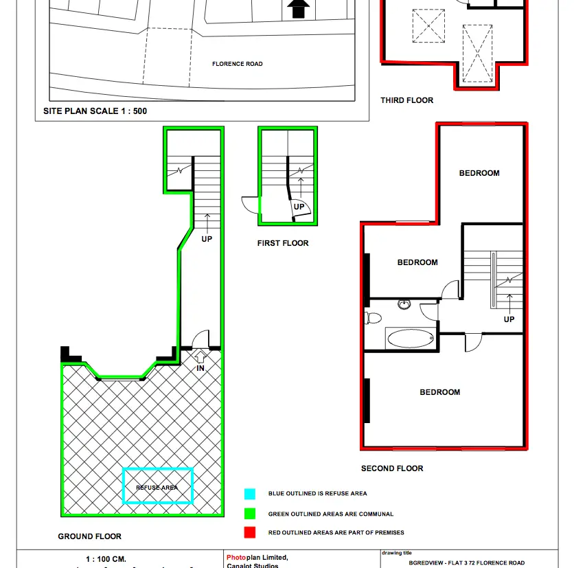
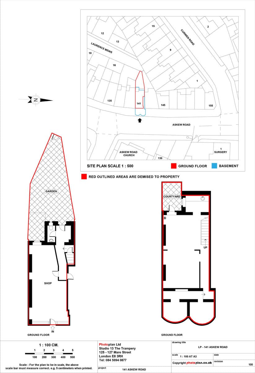
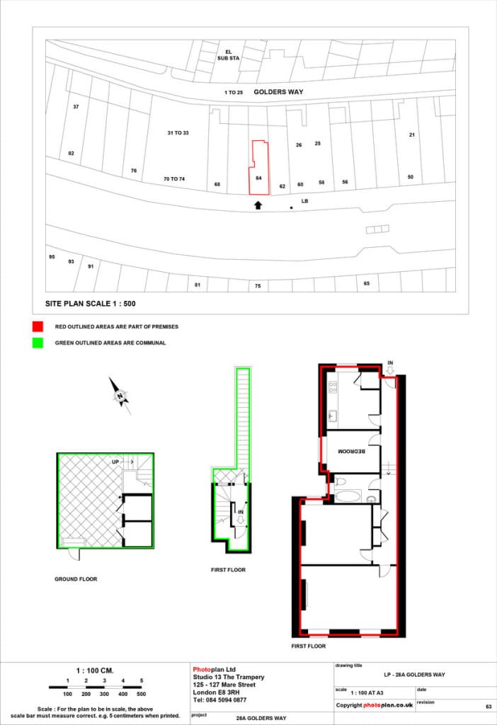
Plans must follow HM Land Registry Practice Guide 40. Our plans are prepared in accordance with current published requirements to help reduce the risk of requisitions.
A compliant application plan is drawn to a recognised metric scale, clearly identifies the land, shows a north point and enough surrounding detail to be located on the Ordnance Survey map. See our Land Registry plan requirements guide for full detail.
HM Land Registry Practice Guide 40 (GOV.UK)Part of the Photoplan group of property plan specialists
Photoplan has produced property plans since 2004
Residential and commercial application plans nationwide
Remote production from drawings or site surveys where needed
Experience across land, plots, estates and commercial parcels
CAD drafting with quality checking against current guidance
Typically 3–5 working days from receipt of the information we need.
Send the property address, title number and any available drawings. Tell us the type of application — transfer of part, first registration, plot sale or title split.
Photoplan reviews your information against HM Land Registry requirements and confirms whether a site survey is required, along with a fixed price.
Your application plan is prepared in AutoCAD and emailed as a PDF for review. Plans are typically completed within 3–5 working days, depending on the property, information supplied and whether a site survey is required.
Once approved, the registration-ready PDF is issued and any included scaled printed copies are posted to your chosen address.
For detailed explanations, read title plans explained.
Send the property address, title number and application type — we will confirm the right plan and a fixed price. Typically 3–5 working days.
Send the property address, title number and application type. Residential plans from £199 + VAT, commercial from £299 + VAT. Typically 3–5 working days.